[ad_1]
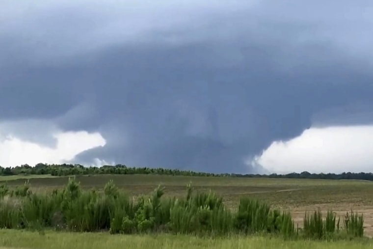
There were seven reports of tornadoes, some with damage, and other reports of high winds Wednesday as rare volatile weather in June hit parts of the Southeast and the Gulf Coast, forecasters said.
No deaths have been reported in the possible tornadoes, which were in Alabama, Georgia and Texas, according to the National Weather Service.
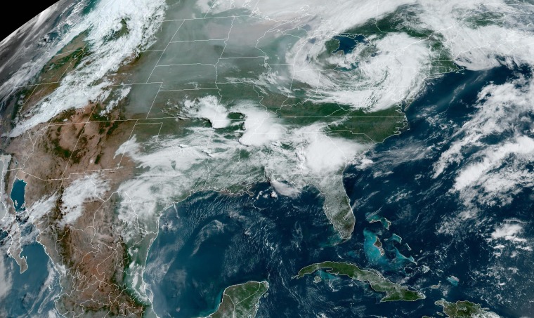
The possible twisters occurred on a day that saw more than 23 million people in the path of multiple waves of severe thunderstorms, which carried the risk of tornadoes.

Severe thunderstorm watches covered parts of Texas, Arkansas, Louisiana, Mississippi and Alabama on Wednesday night. Tornado watches covered parts of Florida and Georgia.
Eufaula, Alabama, suffered damage in what is believed to have been a tornado, the police department in the city of around 12,000 said — and it has seen a tornado in town in four of the last five years.
“We cannot emphasize enough to be weather aware and ready,” the police department said.
In Eutaw, a woman was hospitalized after a storm destroyed the home she was in, Mayor Latasha Johnson said. In Abbeville, a possible tornado tore part of the roof off an Alabama Forestry Commission building, a spokesperson said.
High winds also knocked down power lines. Most of the outages across the South were in Alabama, with around 87,000 customers without electricity Wednesday night, according to tracking website poweroutage.us.
More than 30 million people are in the risk zone for severe thunderstorms from northeast Texas through the Southeast coast into the overnight hours.
The greatest risk of tornadoes was more focused Wednesday afternoon in central/eastern Alabama and southwest Georgia. That includes the cities of Montgomery, Alabama; Dothan, Alabama; and Columbus, Georgia.
Wednesday morning, the Storm Prediction Center declared a moderate risk of severe storms, a level 4 out of 5 on its scale, for a region that does not typically get such a high echelon of severe thunderstorms of that nature during June. For the Southeast and Gulf Coast regions, severe storms are most likely during the early spring months, like March or April. By mid-June, the greatest concentration of severe thunderstorms is typically across the Great Plains.

An unusually strong subtropical jet stream combined with high amounts of warmth and moisture was behind the explosive thunderstorms.
Severe thunderstorm watches had already been up by sunrise Wednesday across parts of Arkansas and Mississippi, the start of round one of multiple rounds of storms projected to blast through the regions over the next 24 hours.
As the day progressed from morning into the afternoon, Alabama and Georgia joined the severe weather threat, with the greatest chance of storms set to occur in the afternoon into the evening hours.
The highly traveled Interstate 20 corridor, including Birmingham and Atlanta, could be affected by the storms, which could produce tornadoes, damaging hail and gusty winds.
Across all of those areas, hail could also exceed 3 inches in diameter, the size of a baseball. Hail of that size is rare for the Southeast at any time of the year. The greatest hail risk includes the areas of northeast Texas, southern Arkansas and northern Louisiana and cities like Little Rock, Arkansas; Shreveport, Louisiana; and Jackson, Mississippi.
The risk continues Thursday for nearly 4 million people across the Gulf Coast and the Florida Panhandle, including the I-10 corridor. Hazards will include damaging hail and gusty winds.
Severe storms are not the only concern for the region, as Mississippi, Alabama, Georgia and the Florida Panhandle are also dealing with flooding concerns from the rounds of storms that could produce up to 5 inches of rain or more locally through Thursday morning. For that reason, flood watches were up for 6 million people across the region. Cities at greatest risk of flash flooding include Birmingham; Tuscaloosa, Alabama; Montgomery; and Savannah, Georgia.
The Northeast could also get some thunderstorms Wednesday, with impacts including gusty winds and small hail. Cities such as Hartford, Connecticut, and Boston could get such storms around 4 to 9 p.m. ET.
Other than storms, Texas is struggling with triple-digit temperatures that are forecast to stick around through the weekend. Heat alerts are in effect for areas from Waco to Brownsville. Highs could vary from 110 to 120 degrees. Records could be broken Friday in cities such as Austin, Dallas, Houston and San Antonio; all are set to soar to the century mark.
[ad_2]
Source link
