[ad_1]

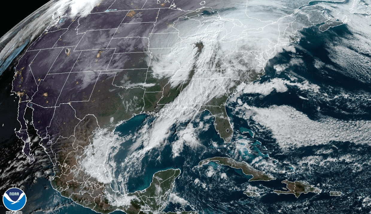
A stretched-out storm system will bring multiple hazards to the eastern half of the country over the next 48 hours, with possible snow, rain, strong thunderstorms and widespread gusty winds.
On Thursday morning, strong storms leftover from Wednesday’s tornado-producing thunderstorms rumbled across the Southeast, Gulf Coast and Florida Panhandle.
On the northern side of the same storm system, strong winds were affecting the Midwest and Ohio River Valley, with some tree damage already reported in Illinois.
Nearly 50 million people woke up to wind alerts on Thursday morning, in an area stretching from Arkansas and northern Alabama up to western and northern New York.
To the west of the thunderstorms, snow was blanketing parts of northern Missouri and much of Iowa, Wisconsin and northern Michigan early Thursday morning. Some thundersnow was even reported in Iowa.
Over the course of the day on Thursday, this dynamic storm system is expected to continue and expand in reach. Strong storms will be possible across two areas in particular: the northern Ohio River Valley and the east-central Gulf Coast and Florida Panhandle.
Damaging winds will be the greatest risk in both regions, with cities like Cleveland; Columbus, Ohio; Indianapolis and Detroit on guard in the northern risk area, and Mobile, Alabama, and Tallahassee, Florida, at risk in the southern area.
Through Friday, the Chicago area is forecast to see peak wind gusts of 35-40 mph. Detroit is bracing for gusts up to 45-50 mph, and Indianapolis may see gusts reaching 55-60 mph. Buffalo, New York, has the strongest winds in its forecast, at 60 mph.
These widespread, long-duration wind gusts will likely down trees, cause power outages and delay air travel through Thursday night.
As the storms roll on, snow will continue across northern Wisconsin and northern Michigan, with several inches expected through Friday morning.
Some showers will also move into the Northeast, with a wintry mix of sleet and freezing rain possible as the storm system’s northern edge interacts with colder air in New England.
But in parts of the Ohio Valley, Mid-Atlantic and Northeast, strong southerly winds will bring a warm, spring-like airmass. High temperatures were forecast to be 15-25 degrees above average on Thursday across the Ohio Valley, with even higher readings expected Friday across the Mid-Atlantic and Northeast.
Temperatures in Richmond, Virginia, are forecast to soar into the 70s, New York City’s into the mid-50s, and those in Washington, D.C., into the mid-60s on Friday, making it feel more like late March than early February.
This warmth could bring about several record highs on Thursday and Friday, including for cities like Detroit; Richmond, Virginia; Hartford, Connecticut; Binghamton, New York; and Providence, Rhode Island.
Temperatures will remain mild by February standards through the weekend.
[ad_2]
Source link
